


 About Urh Social
 Terms of Service
 سياسة الخصوصية
 Contact
What Is Driving the Rapid Expansion of the North America Drone Market?
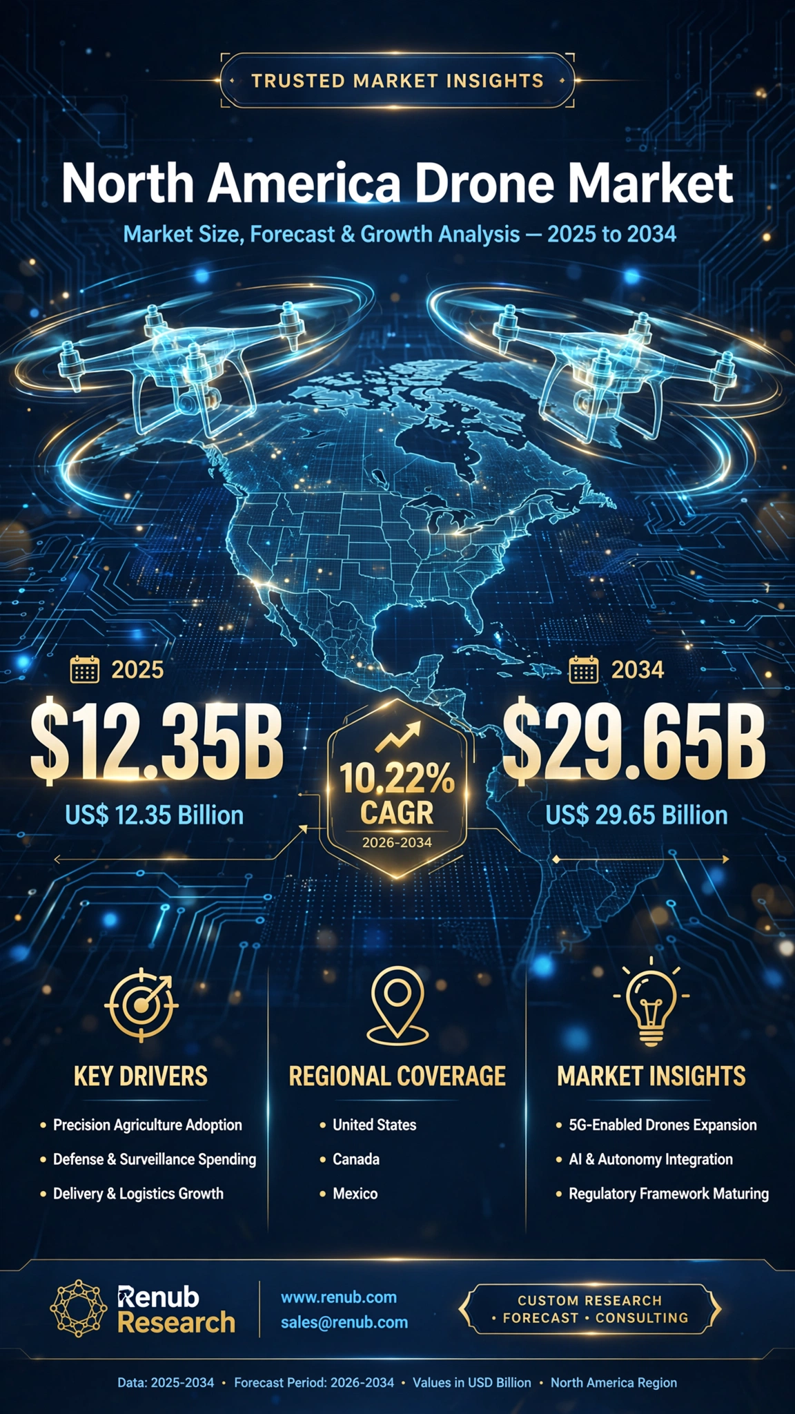
The North America drone market is experiencing a period of historic transformation, shifting from a niche technology used by enthusiasts and specialized military defense teams into a foundational asset across mainstream industrial, enterprise, and civil infrastructure operations. According to recent comprehensive industry data by Renub Research, the North America drone market size is projected to grow from US$ 12.35 Billion in 2025 to US$ 29.65 Billion by 2034. This robust expansion reflects a compound annual growth rate (CAGR) of 10.22% over the forecast period from 2026 to 2034.
This notable commercial momentum is underpinned by several converging dynamics: high-level artificial intelligence (AI) integration, breakthroughs in battery efficiency, automated flight software, and an increasingly supportive regulatory architecture. As businesses and governmental agencies prioritize real-time remote data acquisition, process automation, and crew safety, unmanned aerial vehicles (UAVs) have emerged as indispensable tools for modern economic operations across the region.
What Key Trends Are Shaping North America Drone Launches?
Recent technology debuts demonstrate how rapidly aerial autonomy is evolving to meet demanding environmental and operational mandates across civilian, industrial, and defense applications.
| Drone Model | Company | Launch Year | Core Strategic Capabilities |
| HoverAir Aqua | Zero Zero Robotics | 2025 | World's first fully waterproof self-flying drone tailored for marine conditions and water sports tracking. |
| IQ Nano Indoor Drone | ZenaTech Inc. | 2025 | Ultra-compact autonomous indoor unit for search-and-rescue, high-density warehouse inventory, and close-quarters security. |
| DRONE VOLT KOBRA | DRONE VOLT | 2025 | Heavy-duty professional platform built for high-stakes defense tactical support and emergency response missions. |
| Outrider Border Drone | Draganfly Inc. | 2025 | Extended-endurance platform built for border surveillance, public safety, and multi-sensor aerial oversight. |
| LUCAS System | SpektreWorks | 2025 | Low-cost Unmanned Combat Attack System deployed to optimize cost-effective, long-range naval defense operations. |
| Project Talon | Northrop Grumman | 2025 | Autonomous collaborative combat air platform engineered to support manned aircraft in complex tactical environments. |
| IQ Quad | ZenaTech Inc. | 2026 | Vertical Take-Off and Landing (VTOL) platform tailored for land surveying, real estate asset modeling, and civil urban planning. |
| Guardian | BRINC Drones | 2026 | First-responder platform incorporating direct Starlink satellite connectivity for emergency response in connectivity-blind zones. |
| Wing Delivery Expansion | Wing | 2026 | Expanded commercial urban logistics network integrated directly into major retail and food service delivery supply chains. |
What Do Federal Statistics Reveal About U.S. Drone Adoption?
Federal regulatory data highlights the transition of UAV technology from emergency novelty to structural everyday infrastructure:
-
Over 855,000 Registered Aircraft: The Federal Aviation Administration (FAA) records confirm over 855,860 registered drones active across the United States.
-
Recreational vs. Commercial Split: Recreational registrations represent approximately 63% (536,183 aircraft) of total FAA filings, while official commercial registrations account for 37% (316,075 aircraft).
-
Growing Certified Operator Workforce: Over 405,682 Part 107 Remote Pilot Certificates have been granted to commercial operators, establishing a certified workforce across construction, logistics, and law enforcement sectors.
-
Massive Operational Flight Volume: FAA models indicate that over 38.3 million individual flight operations take place annually in U.S. airspace. Of these, commercial missions account for 16.6 million flights, while hobbyist flights account for 21.7 million.
-
Widespread Remote ID Compliance: Commercial compliance with FAA Remote ID rules has reached roughly 95%, establishing a secure operational framework for complex urban flight corridors.
-
Market Concentration Dynamics: Chinese UAV manufacturer DJI maintains over 50% of the U.S. commercial fleet market share and accounts for over 96% of active aerial detections monitored in U.S. airspace under ASSURE research studies.
What Primary Drivers Are Fueling Market Growth?
Expanding Commercial Applications Across Enterprise Sectors
The rapid adoption of drones across enterprise sectors remains a key structural driver for the North American market. Industries such as agriculture, infrastructure maintenance, energy utilities, commercial construction, real estate, and freight logistics utilize drone platforms to lower operating overhead, limit human safety exposure, and capture hyper-accurate geospatial data.
In precision agriculture, automated drones monitor crop stress indices and execute variable-rate liquid distribution. Construction firms depend on high-resolution photogrammetry to perform volumetric land surveys and real-time site monitoring. Highlighting this industrial growth, AgEagle Aerial Systems Inc. opened its global headquarters, manufacturing center, and innovation hub in Allen, Texas, to scale production of hardware and software solutions across commercial sectors.
Integration of Artificial Intelligence and Next-Generation Hardware
Advances in machine learning and sensor miniaturization continue to expand what UAV platforms can accomplish. AI-powered edge computing allows platforms to perform real-time visual categorization, structural fault detection, and automated collision avoidance without relying continuously on remote pilot commands.
Sensors like thermal cameras, multi-band LiDAR, and multispectral scanners allow enterprises to capture high-density data during a single flight pass. Modern platform capabilities were highlighted by BRINC's launch of Guardian—an advanced emergency response drone equipped with direct satellite connectivity to enable continuous operational uptime regardless of ground-level cellular infrastructure integrity.
Defense Modernization and Evolving Regulatory Pathways
Heightened global national security considerations and tactical shifts toward uncrewed systems have accelerated federal funding for autonomous aerial units. Military agencies deploy specialized UAVs for tactical reconnaissance, target tracking, electronic signals intelligence, and perimeter security.
Concurrently, public air traffic management bodies are developing clear regulatory pathways for Beyond Visual Line of Sight (BVLOS) flights and automated remote operations. Defense innovation is further illustrated by Lockheed Martin's successful live-fire counter-drone test, which launched interceptor missiles directly from containerized shipping units to safeguard critical assets against low-cost uncrewed threats.
       North America Drone Market Expansion (2025 - 2034)

  US$ 30B +-------------------------------------------------- US$ 29.65B
          |                                                   /
  US$ 25B +                                                  /
          |                                                 /
  US$ 20B +                                                /
          |                                               /   (CAGR: 10.22%)
  US$ 15B +                                              /
          |  US$ 12.35B                                 /
  US$ 10B +------*-------------------------------------*
          +------|-------------------------------------|------
               2025                                  2034
What Challenges Are Restricting Faster Adoption?
Complex Airspace Integration and Governance Frameworks
While regulatory frameworks have progressed, navigating layered municipal, state, and national airspace rules remains a operational hurdle. Gaining approvals for complex BVLOS flights, urban delivery runs, and flights over populated areas involves extensive certification cycles that can slow scalable corporate rollouts. In addition, integration with legacy manned air traffic networks demands secure, real-time tracking systems to guarantee spatial separation in crowded environments.
Data Security, Privacy Concerns, and Cyber Vulnerabilities
Because industrial UAVs generate gigabytes of geo-tagged high-definition imagery, spatial point clouds, and vital infrastructure telemetry during a single operational run, they represent prime targets for cyber exploitation. Risks surrounding unauthorized flight control, data interception, and remote access mean operating companies must deploy enterprise-grade encryption and audited software pipelines. Furthermore, persistent public privacy concerns regarding low-altitude surveillance continue to draw municipal legislative scrutiny, creating operational constraints across residential zones.
How Are Industry Vertical Markets Performing?
Precision Agriculture Drone Market
The North American agricultural drone segment is growing rapidly as operators adopt precision farming tools to optimize input costs and preserve soil productivity. Agricultural multirotors and fixed-wing aircraft equipped with multispectral sensors map crop vigor, pinpoint localized weed outbreaks, assess soil moisture gradients, and execute targeted chemical spraying. These automated workflows dramatically lower chemical runoff, minimize manual labor requirements, and assist large agribusinesses across the Midwestern United States and Canadian Prairies in managing vast crop acres efficiently.
Construction and Engineering Drone Market
Construction companies rely heavily on UAV systems to create real-time digital twins of active job sites. High-resolution orthomosaic maps allow project managers to measure bulk stockpile volumes, verify sub-contractor progress, cross-reference structural site layouts against BIM files, and identify site hazards early. Replacing manual surveying methods with automated aerial passes significantly reduces surveying schedules from weeks to hours, limiting costly site rework and preventing field accidents.
Law Enforcement and Public Safety Market
Public safety departments, emergency teams, and municipal law enforcement agencies deploy uncrewed systems to establish rapid aerial awareness during ongoing incidents. Drones assist search-and-rescue teams across wilderness terrain, document traffic accidents with millimeter-level positional accuracy, locate thermal signatures in burning structures, and de-escalate crisis encounters via real-time tactical video feeds, protecting field officers and the public alike.
Rotary-Wing Drone Segment Dominance
Rotary-wing aircraft—including quadcopters, hexacopters, and single-rotor platforms—continue to account for a significant share of commercial hardware revenues across North America. Their ability to hover in place, execute precise maneuvers in enclosed industrial spaces, and execute Vertical Take-Off and Landing (VTOL) without dedicated runway infrastructure makes them ideal tools for utility tower inspections, structural integrity assessments, and urban public safety operations.

 English
 French
 Spanish
 Portuguese
 Deutsch
 Turkish
 Dutch
Dutch
 Italiano
 Russian
 Romaian
 Portuguese (Brazil)
 Greek
Greek